
 |
 |
 |
| Map of Lagos State | Executive Governor Babajide Olusola Sanwo-Olu | Coat of Arms |
| Official Website: http://www.lagosstate.gov.ng | ||
| Population: 9,013,534** (2006 Estimate) Alias: Centre of Excellence | ||
| Chief Judge: Oluwafunmilayo Olajumoke Atilade Speaker, House of Assembly: Rt. Hon. Mudashiru Obasa | ||
GENERAL INFORMATION
Lagos State was created out of the former western region by the then regime of General Yakubu Gowon. It's capital is Ikeja. Prior to this, Lagos Municipality had been administered by the Federal Government through the Federal Ministry of Lagos Affairs as the regional authority, while the Lagos City Council (LCC) governed the City of Lagos. Equally, the metropolitan areas (Colony Province) of Ikeja, Agege, Mushin, Ikorodu, Epe and Badagry were administered by the Western Region.
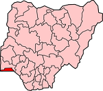
Located in the south-western part of Nigeria, Lagos State occupies 3,345 square kilometres. It shares boundaries with Ogun State both in the North and East and is bounded on the west by the Republic of Benin. In the South it stretches for 180 kilometres along the coast of the Atlantic Ocean. The smallest State in the Federation, it occupies an area of 3,345 square kilometres, 22% or 787sq. km of which consists of lagoons and creeks
The State took off as an administrative entity on April 11, 1968 with Lagos Island serving the dual role of being the State and Federal Capital.
However, with the creation of the Federal Capital Territory of Abuja in 1976, Lagos ceased to be the capital of the State which was moved to Ikeja. Equally, with the formal relocation of the seat of the Federal Government to Abuja on 12 December 1991, Lagos ceased to be Nigeria's political capital.
Nevertheless, Lagos remains the nation's economic and commercial capital.
Lagos State is inhabited by the Aworis and Ogus in Ikeja and Badagry Divisions respectively, with the Ogus being found mainly in Badagry.
While the indigenous population of Lagos are Aworis, there is, nevertheless, an admixture of other pioneer immigrant settlers collectively called Lagosians but more appropriately the Ekos.
The indigenes of Ikorodu and Epe Divisions are mainly the Ijebus with pockets of Ek-o-Awori settlers along the coastland and riverine areas.
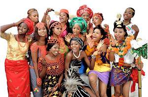
While the State is essentially a Yoruba speaking environment, it is nevertheless a socio-cultural melting pot attracting both Nigerians and foreigners alike.
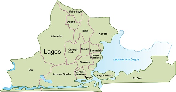
| Local Governments | ||
| Agege Ajeromi-Ifelodun Alimosho Amuwo-Odofin Apapa Badagry Epe |
Eti-Osa Ibeju/Lekki Ifako-Ijaye Ikeja Ikorodu Kosofe Lagos Island |
Lagos Mainland Mushin Ojo Oshodi-Isolo Shomolu Surulere |
 Emergency Numbers (112, 767)
Banks in Lagos
Brief History of Lagos
Business and Economy
Festivals and Carnivals
General and Teaching Hospitals
Hotels and Guest Houses
Interesting Facts
Local Governments & LCDAs
Lagos State Ministries Agencies and Parastatals
Police Stations
Popular Markets
Prominent Towns
Restaurants, Bars, Night Clubs
Shopping Malls
Lagos State Executive Council
Tourist Attractions
Traditional Rulers
CONNECT WITH US
 |
 |
 |
 |