 | 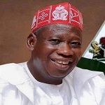 | 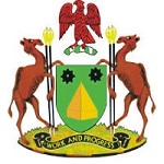 |
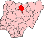
| Map of Kano State | Executive Governor Abdullahi Umar Ganduje | Coat of Arms |
| Official Website: http://www.kano.gov.ng | ||
| Population: 9,383,682 (2006 Estimate) Alias: Centre of Commerce | ||
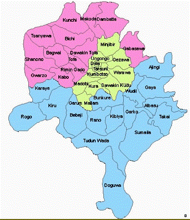
| Local Governments | ||
| Ajingi Albasu Bagwai Bebeji Bichi Bunkure Dala Dambatta Dawakin Kudu Dawakin Tofa Doguwa Fagge Gabasawa Garko Garum | Mallam Gaya Gezawa Gwale Gwarzo Kabo Kano Municipal Karaye Kibiya Kiru kumbotso Kunchi Kura Madobi Makoda | Minjibir Nasarawa Rano Rimin Gado Rogo Shanono Sumaila Takali Tarauni Tofa Tsanyawa Tudun Wada Ungogo Warawa Wudil |
 | GENERAL INFORMATION Kano State was created on May 27, 1967 from the then northern region by the then regim of General Yakubu Gowon. Jigawa State was carved out of Kano State in the state creation exercise of 1991. It's capital is Kano. Located in North-Western Nigeria, Kano State occupies 20,131 square kilometres and is bounded to the north west by Katsina State, north-east by Jigawa State to the north-east, and south by Bauchi and Kaduna States. |
ECONOMY
Kano State is historically a commercial and agricultural state, the centre of commerce. The state produces groundnuts and it is also blessed with solid mineral resources.
Kano state has many dams which include Challawa Gorge and Tiga Dam, two of the most ambitious irrigation projects in West Africa, ensure all year round farming. Kano is known today as the most irrigated state in the country with more than 3 million hectares of cultivable land.
TOURISM
Kano has numerous tourism and cultural centres which include the colorful annual Durbar, leather works and craft. There are museums and monuments which are repertoires of our rich cultural heritage.
TOURIST ATTRACTIONS
Dala HillsEmirs Palace
Kano Durbar
Kano City Wall
Kano Museum
Kofar Matar Dying Pits
Kurmi Market
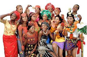
FESTIVALS AND CARNIVALS
Durbar Festival