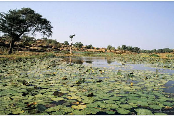
The wetlands lie in the Yobe-Komadugu sub-basin of the Chad Basin. They are formed where the Hadejia and Jama'are rivers meet lines of ancient sand dunes in a northeast-southwest alignment and break into numerous channels. They are drained by the Yobe River, which flows east towards Lake Chad. They lie between Sudanian Savanna to the south and the drier Sahel to the north.

Some of the land is permanently flooded, while other parts are flooded only in the wet season (August and September). Annual rainfall ranges between 200–600 mm, during the period late May–September. At one time the wetlands may have covered up to 3,000 km2. Between 1964 and 1971 over 2,000 km2 were flooded. By 1983 less than 900 km2 were flooded, and less than 300 km2 were flooded in the drought year of 1984.

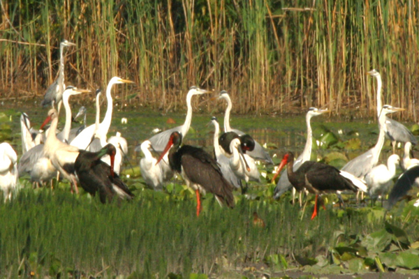
The Hadejia wetland which extends to Nguru in neighbouring Yobe State is a popular tourist attraction in the state. The wetlands provide shelter for various rare and migratory birds.
This sanctuary harbours exotic and rare species of birds. A beautiful place for bird watchers.
Banks in Jigawa
Brief History of Jigawa
Business and Economy
General and Teaching Hospitals
Hotels and Guest Houses
Jigawa State Ministries Agencies and Parastatals
Police Stations
Popular Markets
Restaurants, Bars and Night Clubs
Shopping Malls
Traditional Rulers
Birnin Kudu Rock Painting
Hadejia Wetlands/Nguru Wetlands & Birds Sanctuary
Range Of Quasite Rocks
FESTIVALS AND CARNIVALS
Gani Durbar Festival
Brief History of Jigawa
Business and Economy
General and Teaching Hospitals
Hotels and Guest Houses
Jigawa State Ministries Agencies and Parastatals
Police Stations
Popular Markets
Restaurants, Bars and Night Clubs
Shopping Malls
Traditional Rulers
TOURIST ATTRACTIONS
Baturiya Bird SanctuaryBirnin Kudu Rock Painting
Hadejia Wetlands/Nguru Wetlands & Birds Sanctuary
Range Of Quasite Rocks
FESTIVALS AND CARNIVALS
Gani Durbar Festival


